Not Time to Relax Your Guard: El Niño Has Been Announced, but Storms Still Form Quick
The National Emergency Planning and Training Association wants to keep you informed and prepared. It’s true that El Niño, a climate pattern characterized by warmer ocean temperatures in the Pacific, generally leads to less hurricane activity in the Atlantic. While this might sound like a reason to relax your disaster preparedness, it’s actually a crucial moment for vigilant training and planning. This blog post explores why.
What is El Niño and How Does it Affect Hurricane Season?
El Niño influences hurricane development primarily through its effect on atmospheric conditions. When El Niño conditions are present, stronger wind shear – a change in wind speed and direction with altitude – is created in the upper atmosphere. This wind shear tends to suppress the growth and intensity of tropical systems, thereby reducing the overall number of hurricanes that form during a season.
The Misconception of Reduced Risk
The danger lies in misinterpreting “reduced activity” as “no risk.” A season with fewer hurricanes doesn’t mean no hurricanes. More importantly, it doesn’t mean that rapidly developing or intense storms are impossible. Consider these critical points:
Storms can appear with minimal warning: While major hurricanes get most of the attention, smaller, intense storms can still form quickly, particularly when conditions are favorable, even during an El Niño year. These systems can catch communities off-guard if vigilance is down.
The path is as critical as the intensity: A smaller storm that makes landfall in a densely populated or vulnerable area can cause as much damage as a larger, more powerful hurricane that misses major centers.
It only takes one: Even a “slow” season can be devastating if that one single significant storm makes a direct impact on your community.
Staying Vigilant During El Niño: Why Preparedness Matters More Than Ever
Rather than a signal to unwind, the announcement of El Niño should be a catalyst for focused effort. This is the optimal time for the National Emergency Planning and Training Association to double down on several key preparedness fronts:
1. Review and Update Your Community Emergency Plan
A slow season is the best time for thorough plan review. We encourage you to ask these questions:
- Are evacuation routes up-to-date and clearly communicated?
-
Are shelters identified, adequately supplied, and staffed with trained personnel?
-
Has our community assessment of vulnerable populations (e.g., elderly, medical needs, non-English speakers) been updated?
2. Conduct Simulation Exercises and Disaster Drills
NEPTA strongly advises communities to use this time for realistic training. Simulation exercises are vital for identifying weaknesses in coordination, communication, and response before a real event occurs.
-
Run scenarios that mimic a storm forming with minimal warning.
-
Focus on multi-agency cooperation and test communication systems.
-
Identify bottlenecks and areas needing resource optimization.
3. Update Your Emergency Response Kit
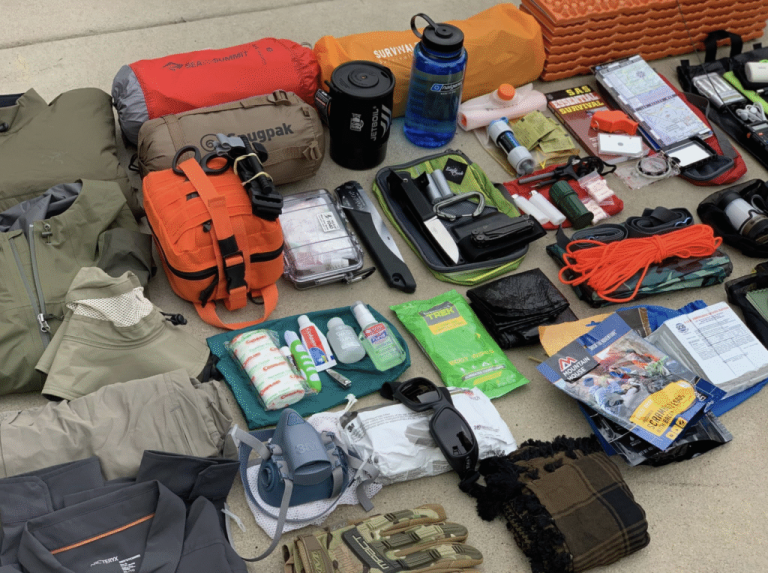
At a personal and organizational level, take a structured inventory of your emergency supplies:
-
NEPTA check: Have expiration dates on water, non-perishable food, and medications been checked?
-
Operational status: Are flashlights, radios (including NOAA weather radios), and spare batteries functioning?
-
Safety supplies: Do you have a fully stocked first-aid kit?
NEPTA’s Commitment to Continuous Preparedness
The National Emergency Planning and Training Association is committed to providing training, resources, and expert guidance to help communities stay prepared for any event, regardless of climate patterns. While El Niño may provide a mathematical advantage, it is not a guarantee of safety. Disaster preparedness is an ongoing, tireless endeavor.
Stay informed, stay trained, and above all, stay vigilant.
#neptanow #myredfolder #preparedness #families #storms #elnino #hurricanes